Zoning
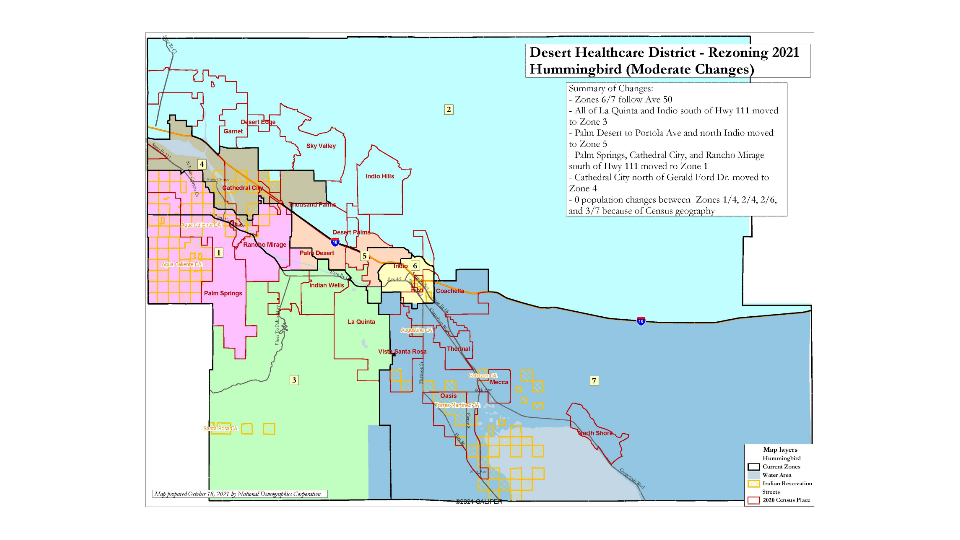
The Desert Healthcare District consists of seven zones covering the Coachella Valley. Each zone is represented by a Director on the Desert Healthcare District and Foundation Board. On December 21, 2021, the Board voted and approved the "Hummingbird" map (linked here), completing a public process that began in the fall 2021 to redraw the District to reflect population changes based on the 2020 U.S. Census.

To find out which zone of the Desert Healthcare District you live in, please view an interactive map of the District here.
Rezoning history
In 2018, prompted by a growing requirement for California’s special districts, municipalities and other government agencies to improve diverse representation, the Desert Healthcare District took on a zoning process that included multiple public hearings and map presentations. A five-zone map was approved that summer, moving the District from at-large to zone-based Board member elections. Following voters’ approval in November 2018 to expand the District east of Cook Street, a rezoning process got underway to create seven zones covering the entire Coachella Valley.
